Lake-enhanced 'snow-showers' expected Friday
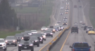
A cold front is bringing a cold, northwest wind through the area on Friday and temperatures are set to fall.
According to CTV News London Meteorologist Julie Atchison, lake-effect snow is expected in parts of midwestern Ontario, and a travel advisory has been issued for Bruce County.
"The London region could see some flurries develop Friday morning as well, with a high of zero degrees, feeling like minus 7C with the wind chill in the morning," she said.
Here’s a look at the rest of the forecast:
Friday: Cloudy. 30 per cent chance of flurries early this morning. A few flurries beginning early this morning. Local amount 2 to 4 cm. High zero.
Friday Night: A few flurries ending near midnight then mainly cloudy. Low minus 6. Wind chill near minus 8.
Saturday: Mainly sunny. High zero. Wind chill minus 8 in the morning.
Sunday: Cloudy with 60 per cent chance of flurries or rain showers. High plus 3.
Monday: A mix of sun and cloud with 30 percent chance of flurries or rain showers. High plus 1.
Tuesday: Cloudy with 30 percent chance of flurries. High zero.
Wednesday: Cloudy with 40 percent chance of flurries. High zero.


CTVNews.ca Top Stories

More than 115 cases of eye damage reported in Ontario after solar eclipse
More than 115 people who viewed the solar eclipse in Ontario earlier this month experienced eye damage after the event, according to eye doctors in the province.
Toxic testing standoff: Family leaves house over air quality
A Sherwood Park family says their new house is uninhabitable. The McNaughton's say they were forced to leave the house after living there for only a week because contaminants inside made it difficult to breathe.
Decoy bear used to catch man who illegally killed a grizzly, B.C. conservation officers say
A man has been handed a lengthy hunting ban and fined thousands of dollars for illegally killing a grizzly bear, B.C. conservation officers say.
B.C. seeks ban on public drug use, dialing back decriminalization
The B.C. NDP has asked the federal government to recriminalize public drug use, marking a major shift in the province's approach to addressing the deadly overdose crisis.
OPP responds to apparent video of officer supporting anti-Trudeau government protestors
The Ontario Provincial Police (OPP) says it's investigating an interaction between a uniformed officer and anti-Trudeau government protestors after a video circulated on social media.
An emergency slide falls off a Delta Air Lines plane, forcing pilots to return to JFK in New York
An emergency slide fell off a Delta Air Lines jetliner shortly after takeoff Friday from New York, and pilots who felt a vibration in the plane circled back to land safely at JFK Airport.
Sophie Gregoire Trudeau on navigating post-political life, co-parenting and freedom
Sophie Gregoire Trudeau says there is 'still so much love' between her and Prime Minister Justin Trudeau, as they navigate their post-separation relationship co-parenting their three children.
Last letters of pioneering climber who died on Everest reveal dark side of mountaineering
George Mallory is renowned for being one of the first British mountaineers to attempt to scale the dizzying heights of Mount Everest during the 1920s. Nearly a century later, newly digitized letters shed light on Mallory’s hopes and fears about ascending Everest.
Loud boom in Hamilton caused by propane tank, police say
A loud explosion was heard across Hamilton on Friday after a propane tank was accidentally destroyed and detonated at a local scrap metal yard, police say.
Shopping Trends
The Shopping Trends team is independent of the journalists at CTV News. We may earn a commission when you use our links to shop. Read about us.


Kitchener
-

Delays in Queen Victoria statue consultation have become 'disrespectful,' say Kitchener Indigenous community leaders
More than a year has passed since the City of Kitchener announced it was pausing community consultations on the future of the Queen Victoria statue in Victoria Park, and there is still no timeline for a resumption of the process.
-
250 Frederick Street ownership tied to alleged reno-victions in London, Hamilton
An investor with ties to apartment buildings across Ontario appears to be connected to 250 Frederick Street in Kitchener.
-
About 10 companies interested in Wilmot land, says Minister of Economic Investment
Ontario’s Minister of Economic Investment, Job Creation and Trade says a number of companies have shown interest in a tract of land the Region of Waterloo is trying to assemble in Wilmot Township.
Windsor
-

NFL Draft: Windsor welcomes as Detroit overflows with fans
All the excitement of the NFL Draft has officially descended upon Detroit, with Windsor welcoming the spillover.
-
Julien’s House opens new Nick Dyer Clubhouse to offer peer-to-peer grief support
A ribbon cutting to celebrate the opening of a new grief support centre on Baseline Road in Windsor marked a bittersweet moment for many at Julien’s House Friday morning.
-
Windsor police seize $120,000 in drugs
Windsor police have arrested two people after seizing $120,000 in illegal drugs.
Barrie
-
One person killed in highway 400 crash in Innisfil
One person killed in multi-vehicle crash in Innisfil on Friday.
-
Gateway Casinos considers relocating from Innisfil venue
With its Innisfil location’s lease set to expire within the next five years, Gateway Casinos is eyeing a plan to move.
-
OPP responds to apparent video of officer supporting anti-Trudeau government protestors
The Ontario Provincial Police (OPP) says it's investigating an interaction between a uniformed officer and anti-Trudeau government protestors after a video circulated on social media.
Northern Ontario
-

Northern Ont. hunters fined $8,500 for illegal moose hunt
Two hunters from North Bay, Ont., and a third from Temagami pled guilty recently to offences they committed during a 2022 moose hunt.
-
Sophie Gregoire Trudeau on navigating post-political life, co-parenting and freedom
Sophie Gregoire Trudeau says there is 'still so much love' between her and Prime Minister Justin Trudeau, as they navigate their post-separation relationship co-parenting their three children.
-
Police in northern Ont. attacked by person they found lying in the street
Ontario Provincial Police responding to a disturbance in West Nipissing this week discovered a conscious person lying in the street.
Ottawa
-

Trucker from Newfoundland missing in eastern Ontario
Ontario Provincial Police are asking for the public's help in locating a missing man from Newfoundland who disappeared in eastern Ontario.
-
'Too young to have breast cancer': Rates among young Canadian women rising
Breast cancer rates are rising in Canada among women in their 20s, 30s and 40s, according to research by the University of Ottawa (uOttawa).
-
Queen’s University names award-winning journalist Shelagh Rogers as next chancellor
Queen’s University says renowned Canadian broadcaster and alumna, Shelagh Rogers will serve as its 16th chancellor starting July 1.
Toronto
-
More than 115 cases of eye damage reported in Ontario after solar eclipse
More than 115 people who viewed the solar eclipse in Ontario earlier this month experienced eye damage after the event, according to eye doctors in the province.
-
Loud boom in Hamilton caused by propane tank, police say
A loud explosion was heard across Hamilton on Friday after a propane tank was accidentally destroyed and detonated at a local scrap metal yard, police say.
-
'Extremely traumatizing:' Boy, 11, struck by transport truck in Etobicoke
An 11-year-old boy struck by a transport truck in Etobicoke on Friday morning suffered critical injuries and is receiving treatment at a Toronto trauma centre, police say.
Montreal
-

'Do I ghost her again?': Quebec minister's office ignores questions on housing as a human right
The office of Quebec Housing Minister France-Élaine Duranceau prefers to openly ignore journalists' requests.
-
Taylor Swift dons Montreal designer's dress in 'Fortnight' video
A pair of Montreal designers' work has now been viewed over 41 million times. Taylor Swift dons a Victorian throwback black gown in her latest music video, 'Fortnight', designed by UNTTLD due Simon Belanger and Jose Manuel Saint-Jacques.
-
Truck driver dies in workplace accident at Port of Montreal
Officials with Quebec's workplace safety board were sent to the Port of Montreal on Friday after a truck driver was killed on the job.
Atlantic
-

First court appearance for boy and girl charged in death of Halifax 16-year-old
A girl and a boy, both 14 years old, made their first appearance today in a Halifax courtroom, where they each face a second-degree murder charge in the stabbing death of a 16-year-old high school student.
-
Cape Breton police find dead body in woods
Cape Breton Regional Police found a dead body in Sydney, N.S., Thursday evening.
-
Community steps up to support popular chef during cancer battle
A popular chef, who is fighting a battle against an aggressive form of cancer, is getting support from her community.
Winnipeg
-

Avs rally for 6-2 win over Jets in Game 3
Nathan MacKinnon and Valeri Nichushkin scored on the power play during a five-goal, third-period outburst and the Colorado Avalanche rallied for a 6-2 victory over the Winnipeg Jets in Game 3 on Friday night.
-
'All these families are now scrambling': Gimli parents concerned about policy changes to child care
Parents in Gimli who rely on child care before and after school are sounding the alarm over policy changes coming in September.
-
Dishing out history: A look back at defunct restaurants in Winnipeg
Take an illustrated look back at the culinary history of Winnipeg.
Calgary
-

Stabbing at Calgary Value Village under investigation by police
Calgary police took two people into custody on Friday after a stabbing in the community of Haysboro.
-
'It's been a wonderful ride': Reunited 'X-Men' cartoon voice cast excited to meet fans new and old at Calgary Expo
If you've spent any amount of time scrolling TikTok at 3 a.m. (it's OK -- we all have), you probably know the meme...
-
Warmer, windy Saturday ahead for Calgary
It will warm up tomorrow, but it will also be gusty at times.
Edmonton
-

Cat who jumped from burning balcony will recover: management company
A cat that jumped from the balcony of a burning building in downtown Edmonton on Thursday afternoon will make a full recovery, building officials say.
-
'So damn undemocratic': Edmonton mayor reacts to legislation granting province power to fire councillors or veto local bylaws
A bill that would empower the Alberta government to remove elected municipal officials or strike down local bylaws is an "attack on local democracy," says the capital city's mayor.
-
DonAir force takes over at Oilers playoff games
As if a 4-0 Edmonton Oilers lead in Game 1 of their playoff series with the Los Angeles Kings wasn't good enough, what was announced at Rogers Place during the next TV timeout nearly blew the roof off the downtown arena.
Vancouver
-

Canucks defeat Predators in Game 3, take 2-1 series lead
J.T. Miller had a goal and assist and the Vancouver Canucks edged the Nashville Predators 2-1 to re-take the lead in their first-round playoff series.
-
Calls for changes to Hwy. 5 after CN Rail worker killed in head-on collision
The 36-year-old killed on Highway 5 this week has been identified as Juver Balmore, a husband and father of three young children who worked for CN Rail.
-
1 man in custody after suspicious fire at Surrey townhome, RCMP say
A fire that displaced three families from a townhouse complex in Surrey's Newton neighbourhood Friday afternoon is considered suspicious, local Mounties say.


