Lake-enhanced 'snow-showers' expected Friday
A cold front is bringing a cold, northwest wind through the area on Friday and temperatures are set to fall.
According to CTV News London Meteorologist Julie Atchison, lake-effect snow is expected in parts of midwestern Ontario, and a travel advisory has been issued for Bruce County.
"The London region could see some flurries develop Friday morning as well, with a high of zero degrees, feeling like minus 7C with the wind chill in the morning," she said.
Here’s a look at the rest of the forecast:
Friday: Cloudy. 30 per cent chance of flurries early this morning. A few flurries beginning early this morning. Local amount 2 to 4 cm. High zero.
Friday Night: A few flurries ending near midnight then mainly cloudy. Low minus 6. Wind chill near minus 8.
Saturday: Mainly sunny. High zero. Wind chill minus 8 in the morning.
Sunday: Cloudy with 60 per cent chance of flurries or rain showers. High plus 3.
Monday: A mix of sun and cloud with 30 percent chance of flurries or rain showers. High plus 1.
Tuesday: Cloudy with 30 percent chance of flurries. High zero.
Wednesday: Cloudy with 40 percent chance of flurries. High zero.
London Top Stories
-
-
-
-
 PLAYOFF TRACKER
PLAYOFF TRACKER London Knights defeat Saginaw in game 1 of Western Conference Finals
-
-
 ICYMI
ICYMIICYMI CTV News London's top stories from this week
-
-


CTVNews.ca Top Stories
Here's where Canadians are living abroad: report
A recent report sheds light on Canadians living abroad--estimated at around four million people in 2016—and the public policies that impact them.
'We are declaring our readiness': No decision made yet as Poland declares it's ready to host nuclear weapons
Polish President Andrzej Duda says while no decision has been made around whether Poland will host nuclear weapons as part of an expansion of the NATO alliance’s nuclear sharing program, his country is willing and prepared to do so.
Harvey Weinstein hospitalized after return to New York from upstate prison
Harvey Weinstein’s lawyer said Saturday that the onetime movie mogul has been hospitalized for a battery of tests after his return to New York City following an appeals court ruling nullifying his 2020 rape conviction.
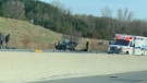
Deadly six-vehicle crash on Highway 400 sparked by road rage incident
One person was killed in a six-vehicle crash on Highway 400 in Innisfil Friday evening.
Invasive and toxic hammerhead worms make themselves at home in Ontario
Ontario is now home to an invasive and toxic worm species that can grow up to three feet long and can be dangerous to small animals and pets.
Central Alberta queer groups react to request from Red Deer-South to reinstate Jennifer Johnson to UCP caucus
A number of LGBQT+2s groups in Central Alberta are pushing back against a request from the Red Deer South UCP constituency to reinstate MLA Jennifer Johnson into the UCP caucus.
Opinion
Opinion I just don't get Taylor Swift
It's one thing to say you like Taylor Swift and her music, but don't blame CNN's AJ Willingham's when she says she just 'doesn't get' the global phenomenon.
Sophie Gregoire Trudeau on navigating post-political life, co-parenting and freedom
Sophie Gregoire Trudeau says there is 'still so much love' between her and Prime Minister Justin Trudeau, as they navigate their post-separation relationship co-parenting their three children.
First court appearance for boy and girl charged in death of Halifax 16-year-old
A girl and a boy, both 14 years old, made their first appearance today in a Halifax courtroom, where they each face a second-degree murder charge in the stabbing death of a 16-year-old high school student.
Shopping Trends
The Shopping Trends team is independent of the journalists at CTV News. We may earn a commission when you use our links to shop. Read about us.