The Forest City will get walloped by snow this weekend
 Snowfall projections for Saturday, Jan. 4, 2025 (CTV News London)
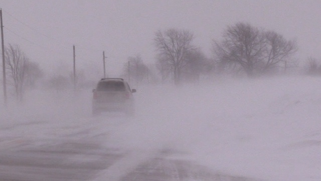
If you’ve tucked your shovel away since the last snowfall, it’s time to haul It back out. Snowfall accumulation could exceed 20 centimeters in London by Sunday morning.
“This is the reinforcement of this arctic airmass, and north westerlies associated with this massive spin of pressure,” said CTV Meteorologist Gary Archibald. “The lake effect engine just continues to pile the snow where we expect to see it.”
It could feel as cold as minus seventeen overnight, “the overnight temperatures just reinforcing this cold air that’s driving the snow across the region,” said Archibald. “Of course, [snow squall] warnings are in place for the great city of London, Parkhill, eastern Middlesex County.”
Some parts of the region could see as much as thirty centimeters of snow before the system runs out of steam.
“Very strong gusting winds reducing visibility, of course that means travel plans could be slowed down,” warned Archibald.
Here’s your London area forecast:
Today: Flurries with risk of snow squalls. Local blowing snow. Local amount 5 cm. Wind northwest 30 km/h gusting to 50. High minus 5. Wind chill near minus 17 degrees.
Tonight: Partly cloudy with 60 per cent chance of flurries. Local blowing snow in the evening. Wind west 30 km/h gusting to 50. Low minus 9. Wind chill near minus 17 degrees.
Tomorrow: Cloudy with 40 percent chance of flurries. High minus 4 degrees.
Monday: Cloudy with 30 per cent chance of flurries. High minus 6 degrees.
Tuesday: Cloudy with 60 per cent chance of flurries. High minus 3 degrees.
Wednesday: Flurries. High minus 6 degrees.
CTVNews.ca Top Stories

Mark Carney reaches out to dozens of Liberal MPs ahead of potential leadership campaign
Mark Carney, the former Bank of Canada and Bank of England governor, is actively considering running in a potential Liberal party leadership race should Justin Trudeau resign, sources tell CTV News.
Here’s the latest on this weekend's winter storms in Canada
From snow, to high winds, to extreme cold, much of Canada is under a severe weather alert this weekend. Here's what to expect in your region.
This Canadian couple has been to 195 countries. Here's what they learned on their eight-year journey
Masha and Robert Glanville, a Canadian couple, sold everything they owned to travel the world full-time. With over 195 countries visited, they focus on mindful, eco-friendly travel and giving back. Here’s what they had to say about their global journey.
WATCH Woman critically injured in explosive Ottawa crash caught on camera
Dashcam footage sent to CTV News shows a vehicle travelling at a high rate of speed in the wrong direction before striking and damaging a hydro pole.
Trump appears with Italian Prime Minister Meloni at his Florida club
U.S. President-elect Donald Trump made an appearance Saturday with Italian Prime Minister Giorgia Meloni, who was visiting his Mar-a-Lago club.
'I gave them a call, they didn't pick up': Canadian furniture store appears to have gone out of business
Canadian furniture company Wazo Furniture, which has locations in Toronto and Montreal, appears to have gone out of business. CTV News Toronto has been hearing from customers who were shocked to find out after paying in advance for orders over the past few months.
Montreal arson squad investigating after commercial space fire bombed
The Montreal police’s (SPVM) arson squad is investigating after a vacant commercial space was fire bombed on Saturday night.
B.C. man ordered to pay damages for smashing Smart car window during road rage incident
A man who smashed the window of a woman’s Smart car during a road rage incident with a former co-worker has been ordered to pay $1,245 in damages by the B.C. Civil Resolution Tribunal.
Hezbollah leader Nasrallah was killed last year inside the war operations room, aide says
Hezbollah leader Hassan Nasrallah was killed in an Israeli airstrike last year while inside the militant group's war operations room, according to new details Sunday disclosed by a senior Hezbollah official.


