Hundreds of weather-related crashes in West Region, while winds reach 100 km/h on Lake Erie shoreline
Police officers in the region have been busy with the first major snow event of the year.
London Police Service (LPS) closed the curve at Glanworth Drive in south London, Ont. Saturday afternoon for a two-vehicle collision, while OPP have dealt with hundreds of crashes since late Friday.
“Members of West Region OPP have been dealing with approximately 440 collisions and counting since 4 o’clock yesterday (Friday) afternoon, and I’m sad to say one of those was a fatal collision in Norfolk County,” said Sgt. Ed Sanchuk of West Region OPP.
In the city of London, road plows have been going non-stop with white-out conditions in some areas.
“Crews have been at it since 5 p.m. yesterday (Friday),” said Joel Gillard, the city’s division manager of road operations. “We've got 70 plows, 48 sidewalk machines, and 28 salt and sander’s that started early and continued through the night.”
The city has also implemented an overnight parking ban on city streets.
“That process is in place because it allows our operators more room to work,” said Gillard. “We can get a better finished product, and we can plow the streets curb to curb with no obstructions in their way.”
100 km/h winds in Port Stanley
While the snow is causing havoc in the London region, the Lake Erie shoreline is under a flood watch as winds reach close to 100 km/h.
“It’s the strongest winds I’ve experienced in my 60 years here,” said Ann Stevens, a business owner and photographer in Port Stanley, Ont.
The wind was so strong people had difficulty getting out of their vehicles and photographers attempting to get pictures of the waves could not set their tripod down, or keep it steady with the heavy gusts.
 Photographers set up on main beach in Port Stanley, Ont. attempting to get a photo of the high waves on Lake Erie on Jan. 13, 2024, (Brent Lale/CTV News London)“I’d say the forecast of 100 km per hour is probably what it’s doing, it’s difficult to stand,” said David Robinson. “It’s fun to get that one picture you just have to frame, it’s an adrenaline rush”.
Jason Hedges came down to try to capture nature’s beauty.
“When you have these wind storms come up, you have a lot of crazy-folk like me show up here,” said Hedges. “You need some sort of wind break to get a good shot. This is probably the worst I’ve seen it, and if you look out there, it is spinning over the pier and it’s pretty cool.”
Due to the high winds and no ice cover to stop the waves, Kettle Creek Conservation Authority (KCCA) has issued a flood watch.
 A seagull struggled to fly directly into the 100 km/hr wind in Port Stanley, Ont. on Jan. 13, 2024. (Brent Lale/CTV News London)“This is the first major wind event of the season and these winds could cause an increased risk of storm surge,” said Jennifer Dow, water resources supervisor for KCCA.
“Last year at this time. Lake Erie was about 40 per cent frozen, so there was shore ice protecting the shoreline line. However, it’s ice free [today]. There’s no protection from that extra erosive power for those waves crashing into the shoreline so it increases risk for storm surge in that area,” said Dow.
London Top Stories
-
-
-
 BREAKING
BREAKING Craig Berube named as next head coach of Toronto Maple Leafs
-
-
-
 BREAKING
BREAKING Windsor Regional Hospital CEO David Musyj heading to LHSC
-
-


CTVNews.ca Top Stories

Serial sexual offender linked to unsolved 1970s homicides of four Calgary girls, women
An investigation into unsolved historical homicides from the 1970s has linked the deaths of two girls and two young women in and around Calgary to a now-deceased serial offender.
Woman with liver failure rejected for a transplant after medical review highlights alcohol use
For nearly three months, Amanda Huska has been in an Ontario hospital, part of it on life support, because of severe liver failure. Her history of alcohol use is getting in the way of her only potential treatment: a liver transplant.
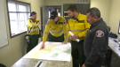
A look back on Alberta's record-breaking wildfire season: Preparing for potential challenges in 2024
By the end of the 2023 wildfire season in Alberta, 1,088 wildfires had burned more than 2.2 million hectares of land, and this year, the wildfire season is already in full swing.
BREAKING
BREAKING Craig Berube named as next head coach of Toronto Maple Leafs
The Toronto Maple Leafs have named Craig Berube as their new head coach.
Video appears to show Sean 'Diddy' Combs beating singer Cassie in hotel hallway in 2016
Security video aired by CNN appears to show Sean 'Diddy' Combs physically assaulting singer Cassie in a Los Angeles hotel hallway in 2016.
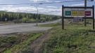
B.C. man 'attacked suddenly' by adult grizzly near Alberta border: RCMP
A B.C. man is recovering from multiple injuries after he was "attacked suddenly" by an adult grizzly bear near Elkford Thursday afternoon.
Australia's richest woman seeks removal of her portrait from exhibition
Art is subjective. And while many artists long to share their work with the world, there's no guarantee that the audience will understand it, or even like it.
Anglers reel in 3.5-metre-long tiger shark off coast of Florida: 'She found my bait'
A group of fishers said it took roughly 20 minutes to reel in this 3.5-metre-long tiger shark off the coast of Florida.
Scottie Scheffler isn't the first pro golfer to be arrested during a tournament
Scottie Scheffler's arrest hours before his second-round tee time at the PGA Championship in Louisville, Kentucky, will go down as one of the most shocking in professional golf history. It certainly wasn't the first, though.
Shopping Trends
The Shopping Trends team is independent of the journalists at CTV News. We may earn a commission when you use our links to shop. Read about us.