Cold front breaks the heat in southern Ontario
 (Source: Ellen Price)
A late-spring heat warning in southern Ontario saw temperatures climb into the low 30s Wednesday and Thursday.
The humidity was oppressive as temperatures soared and felt like the mid-40s.
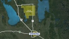
A large upper low in northern Ontario is driving a cold front across the area Thursday, sparking a few showers and thunderstorms.
The clouds will clear Thursday evening and a slightly cooler and less humid air will filter down on a gusty west wind.
The front will clear the area and Friday will be the transition day to cooler conditions.
A cooler and gusty northwest wind will develop Friday morning, with gusts to 70km/h.
As you gear up for the weekend, you can expect a mainly sunny Friday, still hot, the forecast high is in the mid-20s, not as humid, but still feeling close to 30.
It will take the day to scour out the steamy air and the cooler air will settle in over the weekend.
Daytime highs will dip back close to 20 degrees Celsius both Saturday and Sunday.


CTVNews.ca Top Stories

Budget 2024 'likely to be the worst' in decades, former BoC governor says
Without having seen it, former Bank of Canada governor David Dodge believes that Tuesday's 2024 federal budget from Deputy Prime Minister and Finance Minister Chrystia Freeland is 'likely to be the worst budget' in decades.
What's at stake for Canada after Iran's unprecedented attack on Israel
Following the Iranian missile and drone strikes against Israel over the weekend, Canada should take the threat of Iran and potential escalation of the conflict seriously, one global affairs analyst says.
Former B.C. school trustee's 'strip-tease artist' remark was defamatory, judge rules
A controversial former school trustee from B.C.'s Fraser Valley who described a political rival as a "strip-tease artist" during an election campaign has been ordered to pay her $45,000 for defamation.
'A sense of urgency': Sask. man accused of abducting daughter calls himself to the stand during trial
Michael Gordon Jackson, the man on trial after being charged with contravention of a custody order for allegedly abducting his daughter in late 2021 to prevent her from getting a COVID-19 vaccine, called himself to the stand Monday.
Kingston, Ont.'s Aaliyah Edwards drafted into WNBA
After four years at the University of Connecticut, Edwards was selected sixth overall by the Washington Mystics in the WNBA draft Monday night.
NASA confirms mystery object that crashed through roof of Florida home came from space station
NASA confirmed Monday that a mystery object that crashed through the roof of a Florida home last month was a chunk of space junk from equipment discarded at the International Space Station.
A knife attack in Australia against a bishop and a priest is being treated as terrorism, police say
Horrified worshippers watched online and in person as a bishop was stabbed at the altar during a church service in Sydney on Sunday evening.
Body of 14-year-old boy pulled from Lake Ontario, police say he drowned while swimming
The body of a 14-year-old boy has been pulled from Lake Ontario after police say he drowned while swimming near Ashbridges Bay Park on Sunday night.
'Rust' armourer gets 18 months in prison for fatal shooting by Alec Baldwin on set
A movie weapons supervisor was sentenced to 18 months in prison in the fatal shooting of a cinematographer by Alec Baldwin on the set of 'Rust.'
Shopping Trends
The Shopping Trends team is independent of the journalists at CTV News. We may earn a commission when you use our links to shop. Read about us.