All of southern Ontario under special weather statement
All of southern Ontario is covered by a special weather statement Friday morning.
From Windsor-Essex and Chatham-Kent through London-Middlesex and all the way to Cornwall, the statement warns of strong winds with gusts up to 70 km/h and 80 k m/h ahead of a cold front.
The high winds are expected to last through Saturday afternoon and people are being warned about possible power outages.
Friday: Mainly cloudy. Wind becoming south 30 km/h gusting to 50 this morning. High 6. Wind chill minus 7 this morning.
Friday Night: Cloudy. 40 per cent chance of showers overnight. Wind south 20 km/h gusting to 40 becoming southwest 40 gusting to 70 after midnight. Temperature steady near 8.
Saturday: Rain showers ending in the morning then cloudy with 40 per cent chance of flurries or rain showers. Wind southwest 40 km/h gusting to 70 becoming northwest 50 gusting to 70 late in the morning then west 30 gusting to 50. High 9 with temperature falling to zero in the afternoon.
Sunday: Sunny. High plus 3.
Monday: Increasing cloudiness. High plus 5.
Tuesday: Cloudy with 40 per cent chance of showers. High 5.
Wednesday: A mix of sun and cloud. High plus 2.
Thursday: A mix of sun and cloud. High minus 3.


CTVNews.ca Top Stories

LIVE @ 4 EDT
LIVE @ 4 EDT Freeland to present 2024 federal budget, promising billions in new spending
Canadians will learn Tuesday the entirety of the federal Liberal government's new spending plans, and how they intend to pay for them, when Deputy Prime Minister and Finance Minister Chrystia Freeland tables the 2024 federal budget.
BREAKING
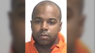
BREAKING Police to announce arrests in Toronto Pearson airport gold heist
Police say that arrests have been made in connection with a $20-million gold heist at Toronto Pearson International Airport one year ago.
Proposed class-action lawsuit against Shoppers Drug Mart alleges 'unsafe and unethical corporate practices'
Shoppers Drug Mart is facing a proposed class-action lawsuit by current and former franchise owners at the retail chain who allege parent company Loblaw engaged in corporate practices that placed them in an “irredeemable conflict of interest” and put patient care at risk.
Lululemon unveils first summer kit for Canada's Olympic and Paralympic teams
Lululemon says it is combining function and fashion in its first-ever summer kit for Canada's Olympians and Paralympians.
Outdated cancer screening guidelines jeopardizing early detection, doctors say
A group of doctors say Canadian cancer screening guidelines set by a national task force are out-of-date and putting people at risk because their cancers aren't detected early enough.
Canada's health-care crisis was 'decades in the making,' says CMA
The strain placed on Canadian health care during the COVID-19 pandemic shows no sign of abating, and the top official of the Canadian Medical Association (CMA) is warning that improving the system will be a 'slow process' requiring sustained investment.
'I just started crying': Blue Jays player signs jersey for man in hospital
An Ontario woman says she never expected to be gifted a Blue Jays jersey for her ailing husband when she sat alone at the team’s home opener next to a couple of kind strangers.
Mussolini's wartime bunker opens to the public in Rome
After its last closure in 2021, it has now reopened for guided tours of the air raid shelter and the bunker. The complex now includes a multimedia exhibition about Rome during World War II, air raid systems for civilians, and the series of 51 Allied bombings that pummeled the city between July 1943 and May 1944.
B.C. woman facing steep medical bills, uncertain future after Thailand crash
The family of a Victoria, B.C., woman who was seriously injured in an accident in Thailand is pleading for help as medical bills pile up.
Shopping Trends
The Shopping Trends team is independent of the journalists at CTV News. We may earn a commission when you use our links to shop. Read about us.


Kitchener
-

Driveway paving scammers reported in Waterloo Region
Cambridge resident Samantha Falkiner explains why something felt "off" about the men who approached her and her neighbours on Friday.
-
Policing costs for St. Patrick’s Day celebrations in Waterloo increased by $51,000
Waterloo Regional Police Services has released the estimated total cost for the St. Patrick’s Day weekend in the city of Waterloo.
-
Brantford police looking for pickpocket suspects
Brantford police are investigating a series of personal thefts and are seeking information from the public to identify the people responsible.
Windsor
-

'He’s done great things': incarcerated Windsorite works to make prison more culturally sensitive for fellow inmates
The ‘faint hope’ hearing of Ali Al-Shammari, 38, continued Tuesday in Superior court.
-
Suspect wanted for 13 thefts at Windsor pharmacies
Windsor police are asking for the public’s help identifying a suspect wanted for a string of retail thefts at local pharmacies.
-
LIVE @ 4 EDT
LIVE @ 4 EDT Freeland to present 2024 federal budget, promising billions in new spending
Canadians will learn Tuesday the entirety of the federal Liberal government's new spending plans, and how they intend to pay for them, when Deputy Prime Minister and Finance Minister Chrystia Freeland tables the 2024 federal budget.
Barrie
-

Casino Rama adds new shows to its 2024 performance lineup
Two new shows are coming to Casino Rama's Entertainment Centre for fans of country music and 80s rock.
-
Apartment fire linked to battery-operated vacuum cleaner
Fire officials say a lithium-ion battery inside a vacuum cleaner sparked a fire at an apartment complex Sunday afternoon in Gravenhurst.
-
Woman plans for vacation and a new home after winning $1M lottery prize
A woman from Alliston will take home a $1 million lottery prize after matching all seven Encore numbers in the exact order on the March 6 draw.
Northern Ontario
-

Northern Ont. driver missing after vehicle pulled into creek
Rescue crews are searching for a man reported missing on the weekend after the vehicle he was driving was pulled into a creek near the Quebec border in northern Ontario.
-
From $60M to $215M: A brief history of Sudbury’s efforts to build a new arena
As city council in Sudbury prepares to debate – again! -- the future of Sudbury Arena, here’s a quick look back at how residents got here.
-
Ontario woman charged almost $7,000 for 20-minute taxi ride abroad
An Ontario woman was shocked to find she’d been charged nearly $7,000 after unknowingly using an unauthorized taxi company while on vacation in January.
Ottawa
-
LIVE @ 4 EDT
LIVE @ 4 EDT Freeland to present 2024 federal budget, promising billions in new spending
Canadians will learn Tuesday the entirety of the federal Liberal government's new spending plans, and how they intend to pay for them, when Deputy Prime Minister and Finance Minister Chrystia Freeland tables the 2024 federal budget.
-
Thousands of dollars worth of tropical fish stolen from Ottawa Valley restaurant
Ontario Provincial Police are investigating the theft of "several thousand" dollars worth of tropical fish stolen from an Upper Ottawa Valley restaurant last week.
-
Ottawa to host Ironman Triathlon in 2025
The city of Ottawa will be hosting the Ironman Canada Triathlon in 2025. The event will take athletes on a tour of the capital via the Ottawa River parkways and the Rideau Canal.
Toronto
-
 BREAKING
BREAKING Police to announce arrests in Toronto Pearson airport gold heist
Police say that arrests have been made in connection with a $20-million gold heist at Toronto Pearson International Airport one year ago.
-
LIVE @ 4 EDT
LIVE @ 4 EDT Freeland to present 2024 federal budget, promising billions in new spending
Canadians will learn Tuesday the entirety of the federal Liberal government's new spending plans, and how they intend to pay for them, when Deputy Prime Minister and Finance Minister Chrystia Freeland tables the 2024 federal budget.
-
Proposed class-action lawsuit against Shoppers Drug Mart alleges 'unsafe and unethical corporate practices'
Shoppers Drug Mart is facing a proposed class-action lawsuit by current and former franchise owners at the retail chain who allege parent company Loblaw engaged in corporate practices that placed them in an “irredeemable conflict of interest” and put patient care at risk.
Montreal
-

Quebec court approves class action alleging opioid makers misled users about risks
A Quebec Superior Court judge has authorized a class-action lawsuit against 16 pharmaceutical companies that are alleged to have misled consumers about the efficacy and dangers of opioid medications.
-
Third referendum: PQ leader's speech is full of 'catastrophism,' says QS
Despite sharing the Parti Quebecois (PQ)'s desire to make Quebec a country, Quebec Solidaire (QS) parliamentary leader Gabriel Nadeau-Dubois has roundly criticized PQ leader Paul St-Pierre Plamondon's speech, calling it 'conservative.'
-
Recycling Montreal's Olympic Stadium roof: international competition collects bids
An international competition is hoping to gather new and interesting ways to recycle Montreal's Olympic Stadium roof, which is set to be dismantled this summer.
Atlantic
-
Inmate who escaped from N.B. prison has long history of violent crimes
An inmate who escaped from Dorchester Penitentiary in Dorchester, N.B., on Saturday evening has a long history of violent crimes and a history of escaping custody.
-
4 people charged in connection with N.S. man’s 2022 death
The Nova Scotia RCMP says four people have been charged following a man’s homicide two years ago.
-
Halifax Transit bus involved in three-vehicle crash in city’s downtown
A portion of Barrington Street has reopened after a three-vehicle crash Tuesday morning.
Winnipeg
-

Teen hockey players arrested for sexual assault following hazing incident: Manitoba RCMP
Three teenagers were arrested in connection with a pair of alleged hazing incidents on a Manitoba hockey team, police say.
-
12-year-old girl finds shotgun on Manitoba beach
Police are investigating after a 12-year-old girl found a sawed-off shotgun on the shores of a Manitoba beach.
-
Colleen Bready's forecast: battle starting between spring and winter
The battle between winter and spring conditions has started in Manitoba on Tuesday.
Calgary
-
Jurors hear closing arguments in trial for three men charged in Coutts blockade
A Crown prosecutor making the case against three men charged with mischief at the border blockade at Coutts, Alta., told jurors Tuesday they don’t have to determine the accused were kingpins of the protest in order find them guilty.
-
Calgary police catch driver travelling more than 100 km/h over the speed limit
Calgary police say the driver of a BMW was given a summons for a mandatory court appearance after being caught travelling more than double the speed limit.
-
Calgary snowfall leads to postponing of some street sweeping
The City of Calgary announced Tuesday that some residential street sweeping operations have been postponed thanks to a dump of spring snow.
Edmonton
-

Ice District watch parties return for Oilers playoffs
The Edmonton Oilers are bringing back watch parties inside and outside Rogers Place when the Stanley Cup Playoffs begin in the coming days.
-
Tamarack Valley shuts Alberta output after gas plant fire
Canada's Tamarack Valley Energy TVE.TO has temporarily shut production of about 6,200 barrels of oil equivalent per day (boepd) following a fire at a Canadian Natural Resources Ltd CNQ.TO gas plant in Alberta, the companies said on Monday.
-
Edmonton municipal golf courses all open by Thursday
Tee-rific news: The City of Edmonton announced Tuesday all its golf courses will soon open for the season.
Vancouver
-

B.C. court upholds conviction after man argues crowds, claustrophobia led to fatal Costco encounter
British Columbia's highest court has upheld a manslaughter conviction against a Vancouver man who shoved a senior outside a busy Costco store, rejecting his argument that the trial judge failed to consider how his claustrophobia and fear of crowds led to the fatal altercation.
-
Downtown Vancouver shooting victim was not 'intended target,' police say
A man who was shot in the face in downtown Vancouver earlier this month was an innocent bystander, according to an update from authorities.
-
B.C. construction sector seeks support as workers shortage, late payments persist
British Columbia's construction industry says its workforce numbers have improved in recent years, but labour shortages persist and are putting “extreme pressures” on employers.


